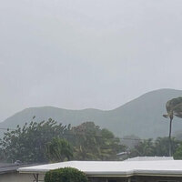


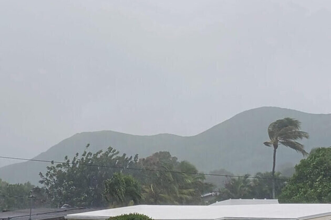
HONOLULU (CN) - A rare and powerful weather system known as a Kona low is battering the Hawaiian Islands with intense rainfall, damaging winds and blizzard conditions at the highest elevations, prompting Governor Josh Green to declare a state of emergency and close schools and government offices across much of the state.
The storm is expected to continue through the weekend, and officials warn the worst conditions may still be ahead.
Flood watches and high wind warnings are in effect statewide. Winter storm watches have also been issued for Hawaii Island summits above 12,000 feet, where forecasters warn of gusts over 100 mph and significant snowfall.
"This is as much water as we've had in five years from a storm of this magnitude," Green said at a press conference Thursday afternoon, flanked by the state's adjutant general, education superintendent and a meteorologist from the National Weather Service. "Please be careful out there."
What is a Kona low?
Under typical conditions, steady trade winds blow from the northeast, bringing rain to windward areas while leaving the leeward sides comparatively dry.
Cole Evans, a meteorologist with the National Weather Service in Honolulu, said a Kona low reverses that pattern.
"The trade winds across Hawaii typically blow from the northeast," Evans told Courthouse News. "A Kona low just kind of reverses that direction."
The shift makes the normally dry leeward sides the wettest areas, dramatically increasing flood risk in places unaccustomed to heavy rain. It can also drive powerful downsloping winds toward windward coasts.
The current system centers on a strong low-pressure area about 1,500 miles northwest of Kauai, drawing deep tropical moisture across the islands.
Forecasters say the system is moving slowly, raising the risk of prolonged impacts.
Scale of the threat
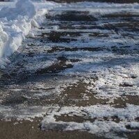
Evans said flash flooding remains the most immediate danger.
Most islands could see several more inches of rain on top of what has already fallen, with 10 to 15 inches possible in some areas and more than 20 inches in higher terrain before the storm clears.
Oahu and Kauai face the greatest rainfall risk, with Maui County close behind. The Big Island, where the storm's strongest impacts are expected later Friday, could see the most extreme conditions at its volcanic summits.
Forecasters also warn of severe thunderstorms capable of producing damaging winds and large hail through Saturday.
Winds in lower elevations could exceed 50 mph, with hurricane-force gusts remaining possible over coastal waters and higher terrain.
Green compared the situation to some of the state's most destructive weather events.
"We've seen bridges go down," he said. "We had completely impassable canyons that had all of their silt taken."
The emergency proclamation remains in effect through March 18.
A storm that can deceive
Evans cautioned that Kona lows can create dangerous conditions that are not always obvious to residents on the ground.
Someone standing in light drizzle may have no idea that intense rainfall or flash flooding is occurring just a few miles away at a different elevation.
That disconnect, he said, is what makes Kona lows particularly dangerous.
"Don't try to drive through flooded roads," Evans said. "That's probably the biggest one during a system like this."
Major General Stephen Logan, Hawaii's adjutant general, echoed those warnings.
Hawaii National Guard resources have been activated across all four counties, he said, and residents should prepare for potential power outages and avoid entering the ocean during the storm.
"Water can rise rather quickly," Logan said.
Schools closed, state offices shuttered
Green ordered all public schools, charter schools and state offices on Oahu, Kauai and in Maui County closed Friday, urging private schools to follow suit.
Officials delayed a decision on closures for the Big Island pending updated forecasts, as the storm's strongest impacts there were expected later in the day.
"The safety of our students and employees is our top priority," Hawaii Superintendent Keith Hayashi said.
Hayashi noted that spring break runs from March 16 to March 20, giving students and staff additional time before schools resume normal operations.
State courthouses on Oahu, Maui, Molokai and Lanai were also closed Friday.
The Hawaii Legislature suspended its session after completing key budget work earlier in the week, and University of Hawaii campuses also announced closures.
When will it end?
The worst of the storm is expected Friday and Saturday, with conditions gradually improving from west to east beginning Sunday.
Evans said conditions should noticeably improve by late Sunday and into Monday, though lingering showers could continue early next week.
More typical weather patterns are expected to return by midweek.
For now, officials are urging residents to stay home, stay informed and avoid flooded roads. Updated information is available at weather.gov/hfo.
Source: Courthouse News Service